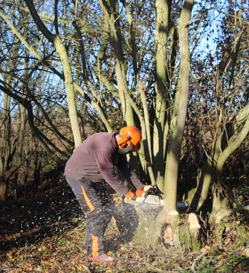
Cutting an ash stool for the second time in 21 years
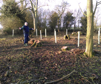
It’s been exciting and a bit emotional to start coppicing Chester Wood for a second time, after a twenty year gap. This was in November and December last year and we managed to get one coup cut before Christmas; an area we first cut in February 1997. Chester Wood is a small piece of ash and hazel coppice on the farm in Bedfordshire – about 0.5 hectares – and this bit of coppicing was the first practical thing we did when we took on the management of the whole 30 hectares in the late 1990s. Last year’s cut marked the first stage in a newly signed off, ten year Woodland Management Plan. The intervening twenty odd years have been eventful so offering up a chainsaw to those same trees for a second time focused my mind on homes, children, business, deaths… ..I’m sure I hadn’t considered the possibility of making this second cut when working on the first all those years ago.
On coppicing the wood that first time, over the course of two winters, we noticed a pattern in the woodland floor that I thought was ridge and furrow – a regular pattern of lumps and troughs formed by the action of repeated ploughing by oxen. It often developed in fields in which many individuals worked strips of land. In 1997, I was working full-time for a local environmental charity and saw Stephen Coleman, the local authority’s Historic Environment Records Officer occasionally, so mentioned this to him in passing. He told me he had no record of any such ridge and furrow in the area. I was busy, time passed and although I didn’t forget the ridge and furrow, by the following summer, new growth obscured the pattern and the evidence was lost.
Nearly twenty one years on, once again we exposed the same subtle wave form in the ground and I made a point of dropping an email to Stephen, now working at Central Bedfordshire Council, and asked him what he thought. It turned out he was interested enough to pop out to see us and the wood, the following week. It probably helped that we are less than two miles from his office as the crow flies. It was good to see him again and to be reacquainted with his immense stash of knowledge and boundless enthusiasm. Stephen rushed around the wood examining everything, zig-zagging between ditches and views, hedges and ancient coppice stools, before scurrying up and down the line of our northern boundary, muttering to himself. The new coppice plot is at the extreme western end of the wood, the furthest point from the entrance, but we eventually managed to bring him to it and to point out the suspected ridge and furrow.
“Yes” he said after another bout of pacing and muttering. “I can’t see what else it can be. Interesting though; we don’t have records of common fields here.” After a pause he added “although there are instances of ridge and furrow on private land. Perhaps that’s what occurred here”. Stephen noticed something else too: many of the ash coppice stools are on the ridge tops so lie roughly in lines. Were they planted there or are they simply more successful in that slightly better-drained soil?
Stephen spots the strip
Inevitably, the self-congratulation I enjoyed on having my theory endorsed by an expert was short-lived. Stephen was back on the northern boundary. Now in the open, cleared by our work, the boundary was easier to examine.
“This looks like a wood bank and ditch” he said, rushing back and forth, peering along the boundary from various angles. He disappeared once again into the dense, uncoppiced wood, returning, nodding but looking perplexed.
“It’s a bit faint in places but I think that’s what it is. The thing is, it’s the wrong way round.”
I’ve read enough about woodland history to be able to have spotted this myself, especially given the twenty thousand times I’ve picnicked, worked and generally pottered about here. One visit by an expert is worth so many amateur ones!
“The bank is usually on the wood side and the ditch on the outside. Here it’s the other way round.” Stephen managed to look pleased and puzzled simultaneously.
Take a look at an Ordnance Survey map of the area, find Chester Wood and move one field to the north west and you’ll find the outline of Cainhoe Park Wood. It’s not named but its ‘ghost’ is noticeable in a form described clearly by Oliver Rackham – distinctly wide and uneven boundaries running around four sides of one large field. It was a wood grubbed out in the 1970s; certainly, local people, including Jane’s mother remember walking and picking flowers there in their childhood. I’ve often speculated that Chester Wood might have been part of that much larger wood, well before living memory, although I’ve never seen any map that shows woodland between Chester Wood and Cainhoe Park Wood. Here, perhaps was some evidence.
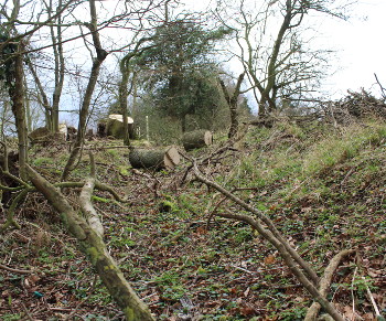
Looking along the ditch with the bank on the right. Chester Wood is to the left
Of course I hadn’t quite considered the ramifications of Stephen’s observation. If this ditch was on the outside of a wood that no longer exists and is now inside Chester Wood, it follows that where Chester Wood now stands there was at some point in the past no wood. It’s been many centuries since anyone thought it worthwhile to create a ditch and bank around their woodland – probably to keep deer out. Such a feature could be a thousand years old. Chester Wood being outside of this long-departed wood ties up very nicely with the identification of ridge and furrow in the wood. At some point in the past, Chester Wood, where we had been coppicing, had been arable and on the other side of the boundary, now arable there had been woodland. An exact reversal.
“But what about all the ancient woodland indicator species that grow in Chester Wood now?” Both Jane and I immediately wondered. “Surely they must point to Chester Wood being old”. “Yes, but…” was Stephen’s reply. Chester Wood must have arisen in a field at some time after arable farming was abandoned or perhaps it was deliberately planted. Either possibility might have occurred any time over the last thousand or more years – there are plenty of existing woodlands that arose after the Black Death of the Fourteenth Century, when farming contracted due to a massive labour shortage. The bluebells, wood anemones, dog’s mercury and other plants whose presence suggest the wood is of some age would have existed in the wood bank of the neighbouring wood and spread easily into the abandoned arable field that is now Chester Wood.
I’ve found all this wonderful and enriching. I often pause during a day’s work, particularly when I’m alone for a long period, to reflect on those who have worked the farm before; Jane’s immediate relatives of course, but those medievals who drove teams of oxen and created that ridge and furrow where Chester Wood and its bluebells now grow. However, I am a bit fed up that I didn’t spot the significance of the bank and ditch, especially as, on reflection, the coppice stools, although clearly big and old, aren’t as big and old as those on the northern boundary
Stephen departed suggesting that it would be interesting to look back at some old maps to see if there’s any documentary evidence to support his field-based conclusion. We weren’t really expecting him to devote any time to this but later that day, we received an email with several attachments – two Nineteenth Century OS maps and two maps of Wrest Park – one of Eighteenth Century and the other of Nineteenth Century origin. He said that although he had found maps showing Cainhoe Park and Chester Woods he hadn’t turned up anything immediately to show woodland between the two. He was however willing to suggest that the evidence, admittedly of a circumstantial nature, supports his earlier assertion.
Now all that remains is to identify when this happened and in what order. Actually, why it happened might be every bit as interesting, but such reasons are rarely recorded so must be inferred. Should I ever have some spare time, I will spend some of it in the Bedfordshire County Records Office and see what can be found in the way of maps and documents, one of which might just contain a record of a massive Cainhoe Park Wood stretching from the north to our current boundary and where Chester Wood now lies, strip farming.
Huge thanks to Stephen for his time and enthusiasm.